Getting to Ginty Creek

Highway 20
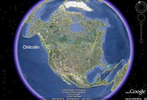
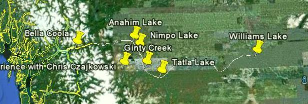
My world encompasses the tiny cluster of yellow dots in the extreme west of Canada, about 300 miles north of Vancouver, BC. The second map shows my neighbourhood. Wilderness Dwellers have very large neighbourhoods.

The thread of road is Highway 20. The distance from Bella Coola to Williams Lake is 450 miles. Ginty Creek is approximately half way between.
If I had driven non-stop, I would have reached Ginty Creek in 9 hours but I stayed near 100 Mile House for the weekend, leaving early in the dull, icy dark to be the first customer at the mechanic’s in Williams Lake on Monday morning. This town houses my nearest bank, traffic lights, and supermarkets. Some last minute shopping (I had accumulated all sorts of bulk dry goods on the book tour – supplies for several months – but I still wanted to add a bit of fresh produce to my grossly overloaded van) and by early afternoon I was heading west along Highway 20 for the last three and a half hours of the journey.
The Chilcotin is a sparsely populated area, which suits those of us who live there just fine. At first it was thawing and the paved road was surfaced with wet sludge. The van became a target for mud thrown up by logging trucks. Every 40 minutes or so along the highway there was a small group of buildings, sometimes an Indian reserve, sometimes a store and a clinic and a few houses, sometimes just a single store-cum-restaurant-cum-postoffice-cum-motel all in a single building.
So close to the shortest day, the light fades early at this latitude (52 degrees north) and for the last lonely stretch, between five and six pm, the dusk gave way to dark. It was higher here, and the temperature hovered around minus 9 degrees Centigrade. The road was dimly white with packed snow, vaguely brown and gritty where it had been sanded on the hills and bends. I was having a hard time seeing, then I remembered the logging trucks and stopped and grabbed handfuls of snow to wipe the headlights clear of mud.
For this last hour I saw not a single other vehicle. What a contrast to the pouring rainy dark of a Vancouver November rush hour!