Things are happening very quickly so I thought I’d give a fire follow-up.
I got out on the evening of 12th July, before the expected strong winds of 13th. On the evening of the 13th, the fire jumped the highway. The bridge is my access so I got out just in time.
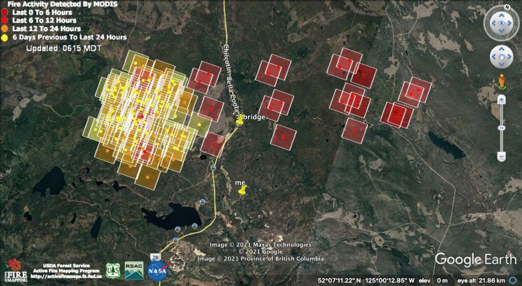
The highway was closed for 40 km north and 20 km south; it was also closed for a long stretch on either side of the Hotnarko Fire in the north. This meant Anahim and Nimpo Lakes were cut off – again; Bella Coola residents always had the option of leaving by sea. In emergencies, extra ferries are put on.
My hosts decided to take a ride to the top of the Bella Coola Hill but although the closure was not supposed to start until well past, they were halted at the bottom of the Hill. As they stood at the barrier, the mail truck (three times a week from Williams Lake to Bella Coola) came by – the driver said he couldn’t figure out what all the fuss was about.
I feared that structural protection crews would not get in as it would be too dangerous, but our Search and Rescue (SAR) manager managed to actually drive in on the morning of the 14th, having to cut only 2 trees out of the way. She saw no sign of structural protection, but a friend later waded the river near my neighbour Jade’s place and said sprinklers were set up on both our houses. It’s not a guarantee of anything, but it is a big relief.
Friends of my hosts were trying to come back to Bella Coola, but they were stopped at One Eye Lake and posted pictures on Facebook.
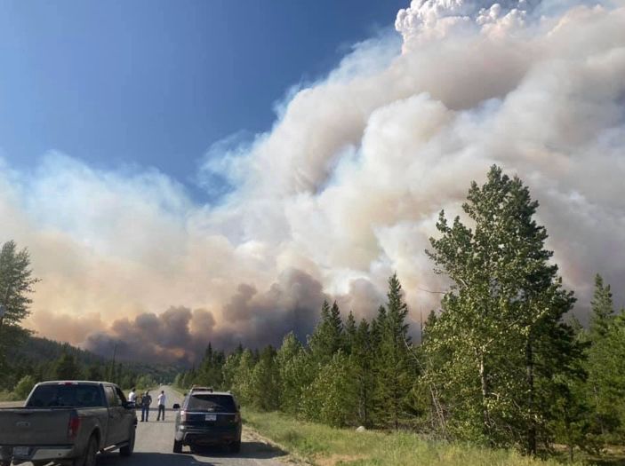
People have been asking how to get onto the Google Earth fire mapping program. To a computer illiterate like me, there is no obvious link. However, my neighbour Jade sent this info:
You have to have Google Earth Pro downloaded first. Then on the Modas/Nasa site you download the kml file you want (I like the one you use with the red, orange and yellow squares for recent activity)In google earth go to File – Open – go to the downloaded file and click itIn the sidebar make sure that file is clicked to see. It should come up with the info on there. You can unclick it anytime to get it off your google earth visuals or delete it to get rid of it by rightclicking.
Another friend sent the FIRMS website. https://firms.modaps.eosdis.nasa.gov/usfs/map/. The opening page is pretty horrifying.
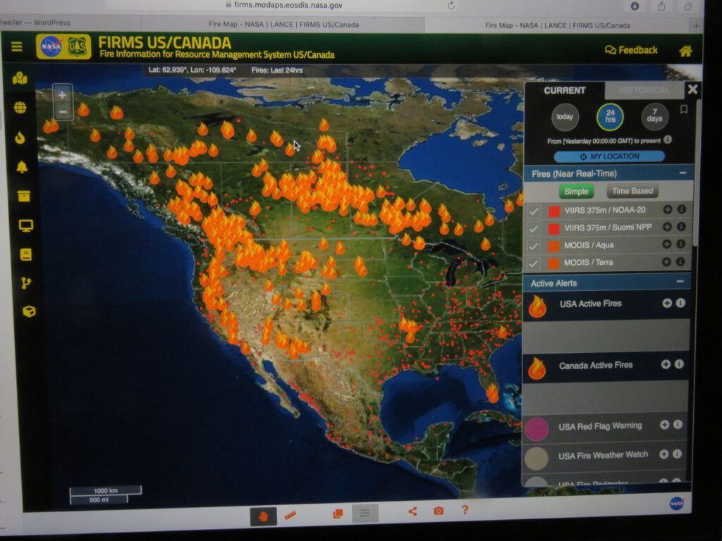
It was a bit tricky to find my fire. When I did, it didn’t show details, nor was I able to put marks on it. You can see Clearwater Lake ; my place is just north of east.
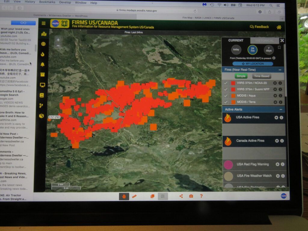
This is what Google Earth shows now. Obviously a quieter day, but there are two hotspots very close to my place.
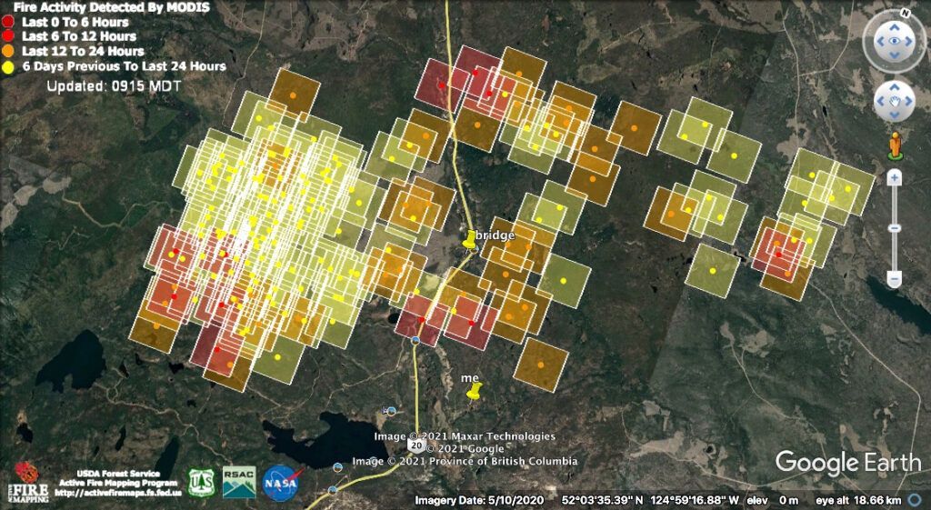
We’ve also had an announcement that they might open the Highway tomorrow at 7.00:AM.
….be advised it could possibly be controlled with pilot cars and or closed again if fires become a threat. ….
I have had such a busy time these last several days and thought today would be more peaceful. But I have had several CBC interviews. Daybreak from Prince George this morning, then CBC Kamloops (I think to be aired later today) then Kelowna for tomorrow morning, and Kelowna for later today. And finally a CBC Vancouver Skype interview to be broadcast at 6.00:PM tonight. If you don’t catch these events live, they can be seen on the websites – they are usually posted the following day.
Tomorrow is supposed to be cooler. Rain in Bella Coola and possible showers at home. The wind will switch to the north and thunderstorms may bring more lightning. Usually north winds are not violent, but the huge flare-up a few days ago happened under just those conditions.
At the moment there is hope for my place. But in 2017, the last big fire event happened August 18. That’s another 5 weeks for nail biting. These fires will never be out until the snow flies.
